
EWP: 2011 Spring Experiment Summary
Working Hypotheses
- Operational meteorologists can provide valuable feedback of experimental severe weather warning decision-making products and displays which are being designed and tested as candidates for operations.
- Operational meteorologists get exposed to the latest research and development ideas when immersed in a collaborative environment, and can carry that information back with them to share with their peers in the operational world.
- Researchers and technology specialists can gain a better understanding of the operational requirements of the severe weather warning forecaster if they work closely with them during real-time warning exercises in a testbed setting.
Specific Objectives
Research Perspective
- To work with GOES-R Proving Ground and collaborators in the development and testing of baseline and potential future satellite products. New for this year, a cross-collaboration with the Experimental Forecast Program’s convective initiation project.
- To work with NSSL and CAPS scientists on the development of Warn-On-Forecast very short-term model guidance and the assimilation packages that will be a part of it.
- To work with Warning Decision Training Branch trainers on the development of best practices for the use of experimental research products designed for transition to operations.
Operational Perspective
- To evaluate the operational utility of Warn-on-Forecast 3DVAR real-time multiple-radar data assimilation technology to determine the potential operational impacts of these data on the WFO nowcast and warning decision process. The products include 3D wind field, vorticity, updraft strength, and reflectivity.
- To evaluate the model performance and forecast utility of the Norman NWS office’s custom Weather Research and Forecasting model (OUN WRF) when WFO operations are expected in the Southern Plains, to assess the utility model for the purpose of forecasting initiation, mode, and dissipation of severe convective storms and to subjectively determine the forecast value of adding high-resolution model output to the suite of tools available in an operational warning environment.
- To evaluate the operational utility of experimental applications intended for the GOES-R satellite platform on the WFO nowcast and warning decision process., including convective initiation products, total lightning data, prior to the launch of the observing platform.
- To identify best practices for using experimental products in nowcast and warning decision making and identifying appropriate display strategies within AWIPS.
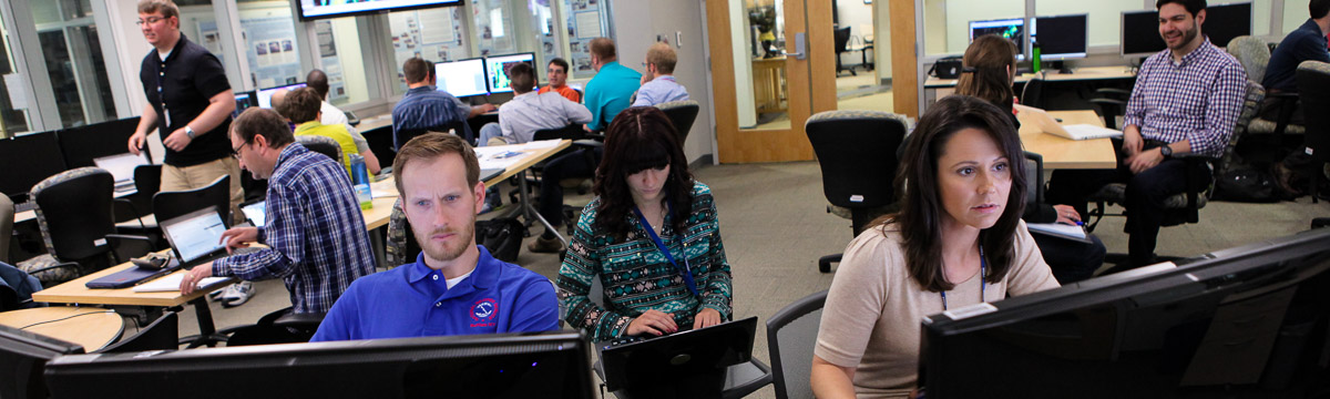
Participants
- NWS WFO: 18
- NWS WDTB: 1
- WSR-88D ROC: 1
- International: 2 (Austria, Germany)
- Academia: 15
- Other NOAA: 0
Preliminary Results
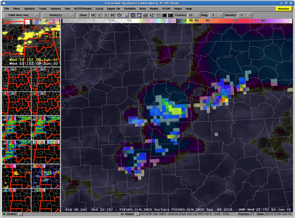
AWIPS display of the 8 km GOES-R Pseudo-Geostationary Lightning Mapper (pGLM) product. [+]
AWIPS display of the 8 km GOES-R Pseudo-Geostationary Lightning Mapper (pGLM) product.
- 3DVAR. Overall, forecasters concluded that the 3DVAR products held much promise for warning operations, in particular the updraft and vorticity products. The data latency was an issue for many forecasters as well as some of the unrealistic artifacts for convective modes other than supercellular. Currently, these two factors place limitations on the usefulness of the data in real-time warning operations, but as computation time continues to decrease and display methods are enhanced, this type of information could become the key to tying together data from multiple sources to reduce the amount of information the forecaster must sort through at any given time.
- OUN WRF. Good for providing information about the timing and mode of convection in the pre-warning time periods.
- GOES-R. Similar results on the CI and overshooting products as last year. The addition of more nowcast products, such as the NearCast and Simulated Satellite products, allowed EWP forecasters to intermingle with the Experimental Forecast Program’s spring experiment in the mornings.
- PGLM. The evaluations show that the PGLM continues to be a successful tool in demonstrating and educating forecasters about total lightning and the upcoming Geostationary Lightning Mapper. The feedback has been positive, but indicates that there are several avenues for improvement, which in turn can be provided to the GOES-R program to help develop the real-time GLM products, once the instrument is launched. Forecasters have indicated that additional training and examples would be useful as well as improved color curves for the data. The forecasters overwhelmingly indicated that a time series plot of lightning data would be immediately beneficial as well as wanting to see an intra-cloud flash to cloud-to ground strike ratio.
Payoff
- The visiting forecasters made a number of helpful suggestions that were adopted to improve the operations of the spring experiment for EWP2012. These included:
- Move the training location to the forecaster’s WFO, to be taken prior to arrival for testbed activities. This would free up an extra day of real-time operations on Mondays.
- Add new updraft helicity products (current value and tracks) to the output of the 3DVAR system, in order to better diagnose and track supercell storms.
- Provide expressions of uncertainty to the GOES-R convective initiation products, instead of the deterministic yes/no output.
- The UWCI product was modified by the addition of the cloud optical depth measurements to improve detection of convective initiation signals under cirrus. Furthermore, relationships between cloud-top cooling rates and severe weather were developed.
Related Publications
- Gao, J., D. J. Stensrud, and M. Xue 2009: Three-dimensional Analyses of Several Thunderstorms observed during VORTEX2 field operations. Extended Abstracts, 34th Conference on Radar Meteorology, Williamsburg, VA., P9.8.
- Gao, J., D. J. Stensrud, T. M. Smith, K. Manross, J. Brogden, K. Kuhlman, 2011: A Realtime Weather-Adaptive 3DVAR Analysis System with Automatic Storm Positioning and On-demand Capability. Extended Abstracts, 35th Conference on Radar Meteorology, Pittsburg, PA, USA, AMS, 115.
- Hitchcock, S.M., P.T. Marsh, H.E. Brooks, and C.A. Doswell III, 2010: Impacts of varying the integration depth on performance of updraft helicity as numerical guidance for severe thunderstorms forecasting. Extended Abstracts, 25th Conf. on Local Severe Storms. Denver, CO, Amer. Meteor. Soc., P7.7.
- Kuhlman, K. M., T. M. Smith, J. Gao, K. L. Manross, K. L. Ortega, G. J. Stumpf, 2012: Real-time 3DVAR analyses and forecaster evaluation during the 2011 Hazardous Weather Testbed Experimental Warning Program. Extended Abstracts, 16th IOAS-AOLS, New Orleans, LA, USA, AMS, 3.6.
- Reed, B., M. DeMaria, S. J. Goodman, J. Gurka, D. Reynolds, and C. W. Siewert, 2012: GOES-R Proving Ground - Demonstrating GOES-R Products in 2011. Eighth Annual Symposium on Future Operational Environmental Satellite Systems, New Orleans, LA, Amer. Meteor. Soc., 5.5.
- Sieglaff, J. M., L. M. Cronce, W. F. Feltz, K. M. Bedka, M. J. Pavolonis, and A. K. Heidinger, 2011: Nowcasting convective storm initiation using satellite-based box-averaged cloud-top cooling and cloud-type trends. J. Appl. Meteor. Climatol., 50, 110–126.
- Smith, T. M., D. L. Andra, Jr., M. P. Foster, G. J. Stumpf, D. W. Burgess, 2011: Research-to-Operations in the NOAA Hazardous Weather Testbed's Experimental Warning Program. Extended Abstracts, 1st Conf. on Transition of Research to Operations: Successes, Plans and Challenges, Seattle, WA, USA, American Meteorological Society, 823.
- Smith, T. M., D. L. Andra, M. P. Foster, 2012: The NOAA Hazardous Weather Testbed's Experimental Warning Program. Proc. The Conference on Weather Warnings and Communication, Oklahoma City, OK, USA, AMS, J2.6.
- Stano, G. T., K. M. Kuhlman, C. W. Siewert, and B. Carcione, 2012: Evaluations of NASA SPoRT’S Pseudo-Geostationary Lightning Mapper Products in the 2011 spring program. Eighth Annual Symposium on Future Operational Environmental Satellite Systems, New Orleans, LA, Amer. Meteor. Soc., 501.
- Stensrud, D. J., and Coauthors, 2009: Convective-scale warn-on-forecast system: A vision for 2020. Bull. Amer. Meteor. Soc., 90, 1487–1499.
- Stensrud, D. J., J. Gao, T. M. Smith, K. Manross, J. Brogden, and V. Lakshmanan, 2010: A real-time weather-adaptive 3DVAR analysis system with automatic storm positioning and on-demand capability. Abstract, 25th Conference on Severe Local Storms, Denver, CO, Amer. Meteor. Soc., 8B.1.